Mapping Sustainability: How Geospatial Mapping Provides Insights for ESG Compliance 

The world is shifting! Investors are demanding more than just financial returns; they want to see companies actively contributing to a sustainable future. This is where Environmental, Social, and Governance (ESG) factors come in. But how do we truly measure a company’s ESG performance? The answer is geospatial data!

The rapidly growing availability of geospatial data paves the way for better evaluation of Environmental, Social and Governance (ESG) performance and ultimately, better informed ESG investing. Imagine a world where companies can pinpoint areas of environmental degradation, assess the social impact of their operations on local communities, and track their progress towards sustainability goals – all through the power of maps. This is the future that geospatial data is unlocking.

This blog explores how geospatial data management empowers companies to address environmental, social, and governance issues effectively.

But first, let’s understand ESG.

What is ESG?

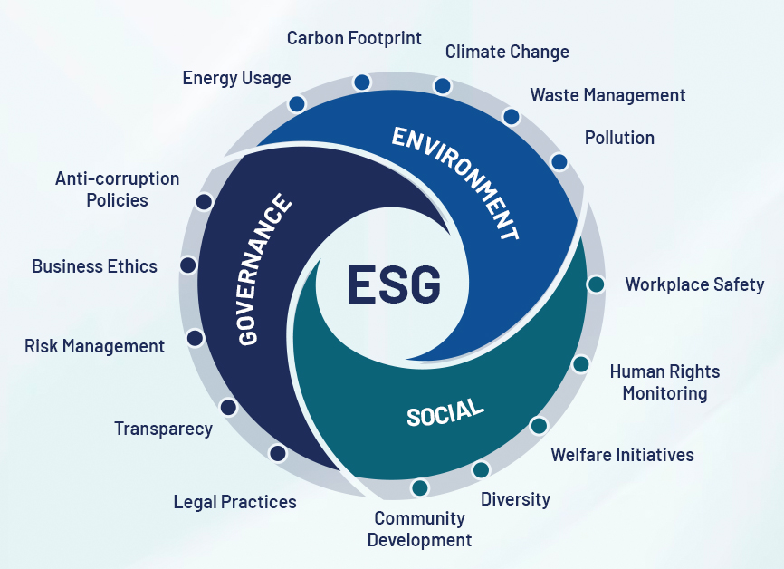
ESG, short for Environmental, Social, and Governance, encompasses a set of criteria used to assess the sustainability and ethical impact of companies or organizations. These criteria are pivotal for investors, stakeholders, and society to gauge the ethos of businesses and institutions.

  • Environmental (E): Focuses on a company’s impact on the environment, covering areas such as climate change, resource management, and biodiversity.
  • Social (S): Assesses how a company interacts with its employees, customers, communities, and other stakeholders, including factors like labor practices, human rights, and community engagement.
  • Governance (G): Refers to the systems and structures guiding a company’s decision-making processes and overall corporate behavior.

Decoding ESG: Environmental, Social, Governance criteria crucial for sustainable business practices

Geospatial ESG Fundamentals

Geospatial ESG involves leveraging geospatial data to scrutinize the environmental impact and other ESG variables across diverse entities, including commercial assets, companies, portfolios, or geographical regions. This process initiates with precise asset location and ownership definition, culminating in insights drawn from observational data.

Integration of Data Sources

Geospatial data seamlessly integrates with ground monitoring data and traditional ESG data points, enriching insights. This amalgamation furnishes independent, global perspectives on environmental impact and risks, offering benefits to singular assets, companies, or entire regions.

Key Technologies in Geospatial ESG

  • Geographic Information Systems (GIS): Empowers precise mapping and analysis of environmental data, vital across various sectors.
  • Remote Sensing: Provides real-time data on land use, forest cover, and water quality, pivotal for informed decision-making.
  • Spatial Data Analytics: Monitors environmental shifts, evaluates risks, and ensures sustainable resource management.
  • Building Information Modeling (BIM): Facilitates detailed digital representations of buildings and infrastructure, optimizing energy consumption and sustainability.

Geospatial ESG Across Sectors

  • Urban Development: Facilitates smarter city planning, infrastructure management, and the promotion of green building practices.
  • Agriculture: Optimizes crop yields, manages water resources, and mitigates environmental impact.
  • Forestry: Enables monitoring of deforestation, tracking biodiversity, and conservation area management.
  • Disaster Management: Assists in risk assessment, emergency response planning, and resilience building.

How Geospatial Technology Drive ESG Integration and Climate Resilience for a Sustainable Future?

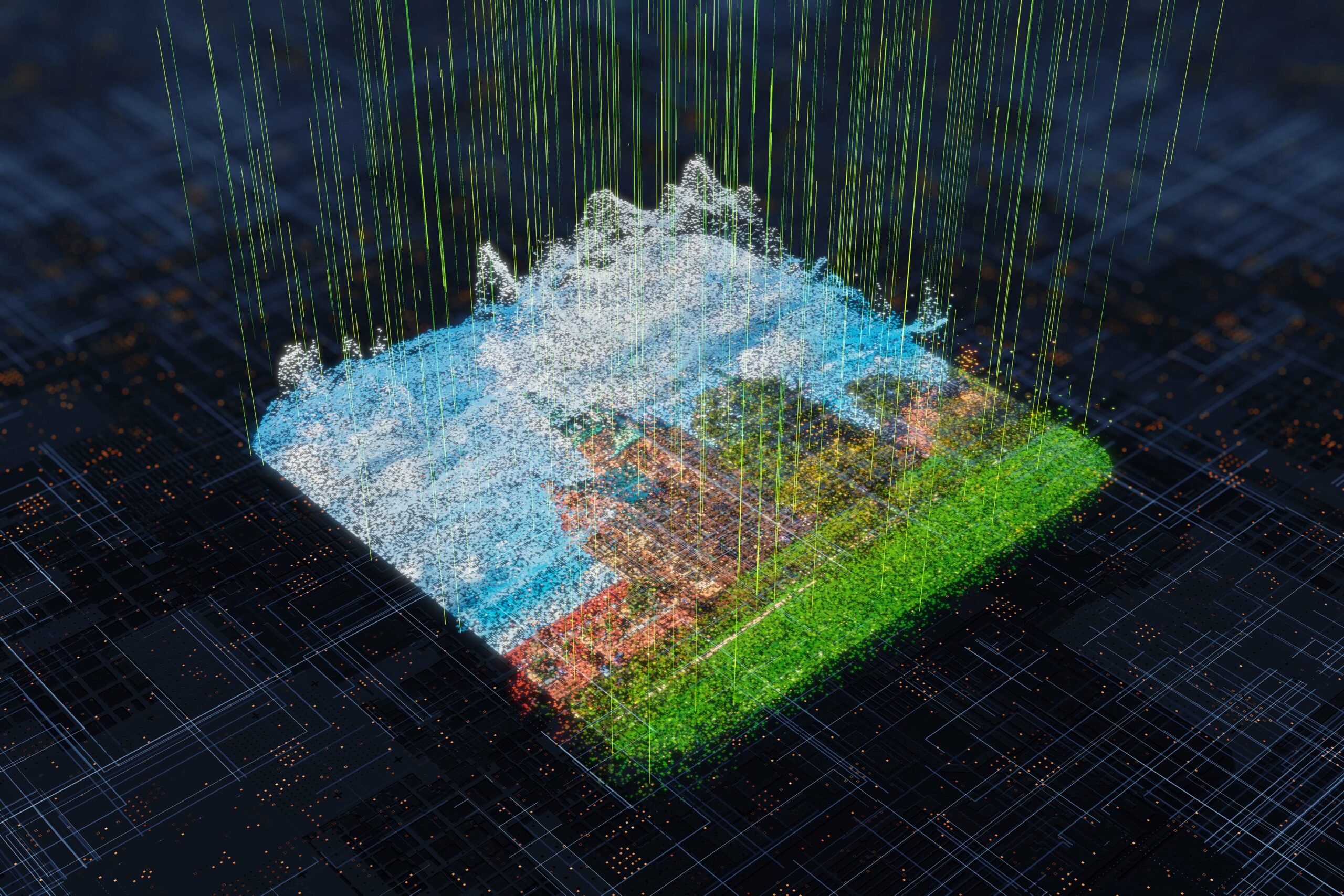
The World Bank estimates that over 90% of global disasters are weather-related. This highlights the critical role of geospatial technology (geo-tech) in building resilience and driving sustainability. Geo-tech is a powerful toolkit that utilizes geographic data and analysis to tackle climate challenges and accelerate the shift towards a greener future. It encompasses tools like geographic information systems (GIS), remote sensing, light Detection & ranging (LiDAR) and satellite imagery etc.

Let’s explore how geo-tech empowers companies to integrate ESG principles and build climate resilience for a sustainable future.

1. Enhanced Decision Making

Geospatial data provides a comprehensive view of environmental dynamics, social demographics, and governance. Integrating this data into ESG frameworks helps decision-makers gain insights into the interconnectedness of various factors such as environmental degradation, social vulnerability, and governance effectiveness, leading to more informed and holistic decision-making.

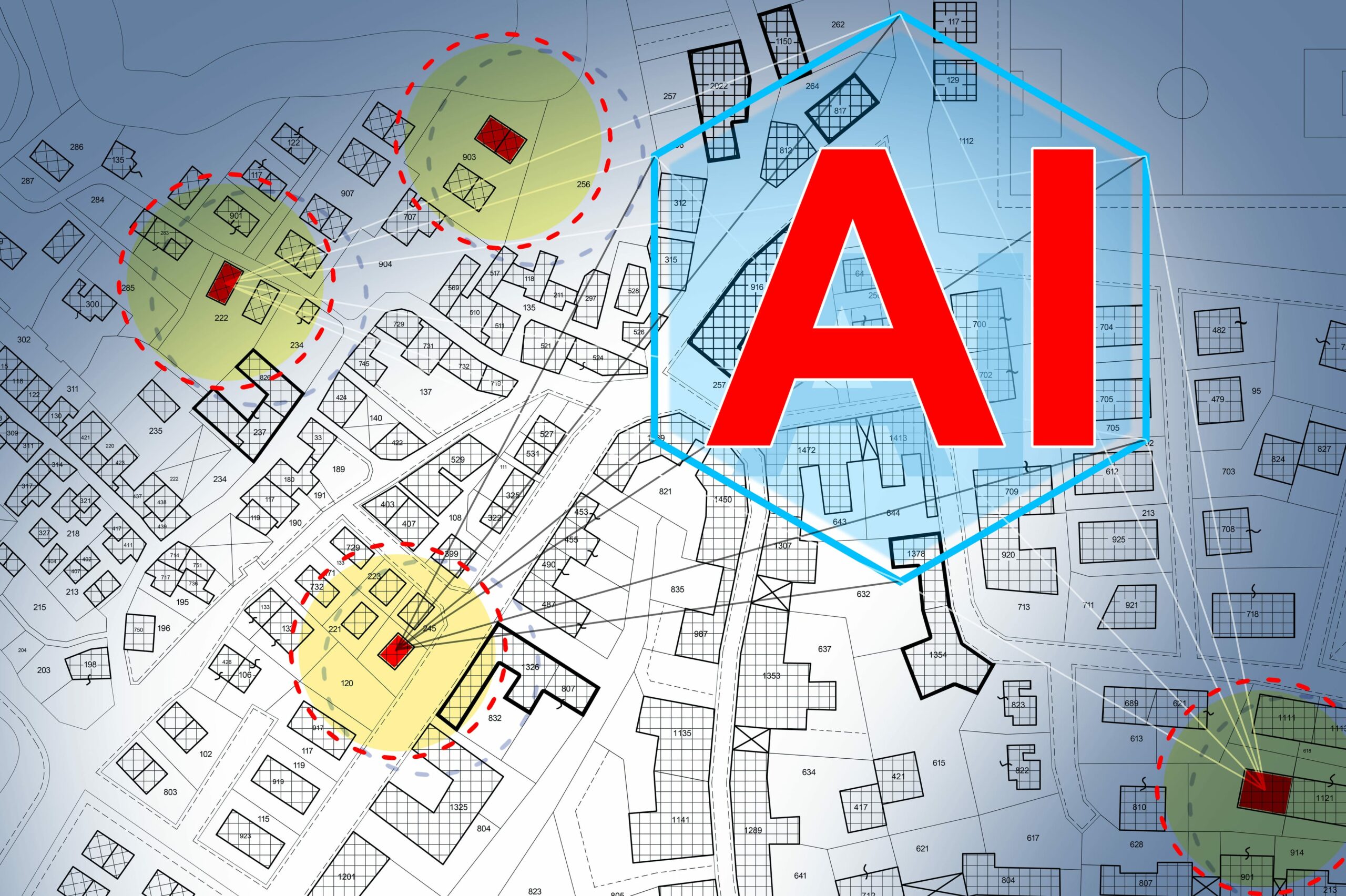
2. Risk Assessment and Management

Geospatial technology precisely maps environmental risks such as floods, wildfires, and sea-level rise. Overlaying these maps with social and economic data helps companies and governments assess the potential impact on communities and infrastructure. This allows for proactive risk management strategies, including the development of climate-resilient infrastructure and the implementation of early warning systems to mitigate disasters.

3. Supply Chain Transparency

Geospatial technology facilitates the monitoring of supply chain activities, from raw material sourcing to product distribution. Satellite imagery and GPS tracking help trace material origins, monitor land-use changes, and ensure compliance with environmental regulations, promoting sustainable practices and identifying areas for improvement.

4. Natural Resource Management

Geospatial data offers insights into sustainable management of natural resources. For instance, satellite imagery can monitor deforestation patterns, assess biodiversity hotspots, and track changes in land cover over time. Integrating this data into ESG strategies aids in conservation, ecosystem restoration, and promoting sustainable land use, mitigating climate change impacts.

5. Community Engagement and Resilience Building

Geospatial technology facilitates community engagement by empowering local stakeholders with valuable information about their environment. Participatory mapping and citizen science help identify hazards, assess vulnerabilities, and co-design adaptation strategies, fostering tailored resilience-building efforts to withstand climate-related challenges.

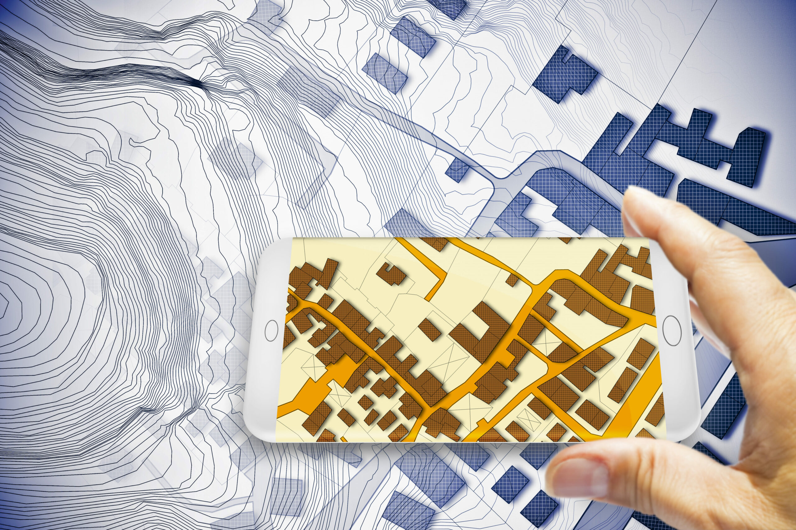
6. Measuring and Reporting ESG Performance

Geospatial technology provides tools for accurately measuring and reporting ESG performance accurately. By leveraging spatial analytics, companies can quantify their environmental footprint, assess social impact, and evaluate governance practices. Geospatial dashboards and interactive maps offer a user-friendly interface for visualizing complex data sets and tracking progress towards sustainability goals. This transparency fosters accountability and enhances stakeholder trust, driving continuous improvement in ESG performance.

Conclusion

Geospatial mapping is pivotal for ESG compliance and informed decision-making. It allows companies to assess environmental impact, social dynamics, and governance structures accurately. Integration of geospatial tech into ESG frameworks empowers stakeholders to drive positive change and resilience against climate challenges. From urban planning to disaster management, agriculture to forestry, geospatial mapping provides actionable insights for sustainability. 

Magnasoft’s approach to energy-efficient refurbishments ensures comprehensive and effective results. Our comprehensive environmental assessments provide actionable insights, and our global delivery model offers flexibility for large-scale projects. By integrating these steps, we are paving the way in making our projects more sustainable and efficient, adhering to ESG principles. For more information about our services, contact us directly. Together, we can build a sustainable future.

This blog serves as a prelude to our next discussion on the practical applications of these initiatives. Our upcoming blog will delve into specific projects executed by Magnasoft, highlighting our contributions to ESG in the context of building and infrastructure sectors. We will explore how geospatial technologies are being used to enhance the sustainability and efficiency of buildings, making them more eco-friendly and resilient.

Reshaping Connectivity: How Advanced Telecom Asset Management is Pioneering the Future of Digital Infrastructure

In the dynamic realm of telecommunications, the strategic management of infrastructure—from towering cell masts to sprawling network systems—is not merely about upkeep but about forging the future of connectivity. For Tower Companies (Towercos), Tower Owners, and Mobile Network Operators (MNOs), the stakes have never been higher. This blog unveils how leveraging state-of-the-art geospatial technologies and undergoing significant structural reforms are not only enhancing day-to-day operations but also reshaping financial landscapes and service paradigms. As digital transformation accelerates, these players are uniquely positioned to capitalize on emerging opportunities, driving innovation and profitability in an increasingly complex digital landscape.

Everything You Need to Explore in Telecom Asset Management

Telecom Asset Management encompasses the holistic approach to managing telecom assets throughout their lifecycle, ensuring operational efficiency and maximizing return on investment. TAM involves detailed inventory management, rigorous maintenance schedules, strategic deployment, and leveraging of cutting-edge technologies like IoT for real-time monitoring and management. Cost management, compliance with regulatory standards, and environmental considerations are also integral to effective TAM. This comprehensive management strategy covers everything from physical infrastructures like towers, antennas, and related equipment for Towercos and Tower Owners, to the digital assets and network services critical for Mobile Network Operators (MNOs).

By systematically managing these facets, telecom companies can enhance service delivery, reduce operational costs, and improve customer satisfaction.

Understanding Telecom Asset Management for Towercos and Network Operators

Telecom Asset Management (TAM) for Towercos and Network Operators is a comprehensive approach to managing the entire lifecycle of telecom assets, which includes not only the physical towers but also the equipment and real estate associated with them. This management practice is crucial for maintaining efficient operations, optimizing site performance, and ensuring compliance with various regulatory standards.

Key Aspects of Telecom Asset Management:

1. Centralized Data Management: TAM systems centralize all data related to tower assets, eliminating the need to access multiple systems and spreadsheets, thus reducing discrepancies in asset data and enhancing usability.

2. Lifecycle Tracking of Assets: TAM systems track every asset from installation through maintenance to decommissioning, encompassing all aspects of their lifecycle.

3. Comprehensive Real Estate and Equipment Management: TAM extends beyond just the towers themselves to encompass associated real estate and various types of telecom equipment, ranging from passive assets like HVAC systems to active assets like antennas.

4. Accurate Asset Inventory for Capacity Assessments: TAM ensures accurate site asset inventories are performed, enabling capacity assessments that are crucial for planning and expansion.

5. Enhanced Asset Visibility for Strategic Decision-Making: Through cloud-based dashboards that integrate all asset data, TAM systems enhance asset visibility, supporting better strategic decision-making regarding asset deployment, maintenance, and upgrades.

In summary, Telecom Asset Management is vital for Towercos and Network Operators as it helps streamline operations, ensure asset reliability, and support strategic decision-making, thereby improving service delivery and operational efficiency. This integrated approach to managing assets ensures that every component of the telecom infrastructure is accounted for, maintained, and utilized effectively to meet the demands of a dynamic telecommunications environment.

The Role of Geospatial Services in Telecom Asset Management

The integration of geospatial services into Telecom Asset Management (TAM) has revolutionized the approach to managing telecom infrastructure, making it more precise, efficient, and predictive. By incorporating technologies like drone surveys, 3D digital twinning, detailed mapping, and AI/ML-powered analytics, TAM is transforming into a highly sophisticated domain that significantly enhances asset oversight and operational intelligence.

Drone Surveys

Drone technology facilitates comprehensive aerial surveys of telecom sites, providing high-resolution imagery that is crucial for accurate site analysis and planning. These surveys help in identifying potential issues before they become problematic, ensuring that maintenance can be proactive rather than reactive. The data collected via drones is particularly valuable for remote or hard-to-access sites, offering a clear overview without the need for physical site visits.

3D Digital Twin Tower Modeling

3D digital twins create a virtual replica of physical telecom towers and their surrounding environment, allowing for real-time monitoring and scenario testing. This model is an invaluable tool for visualizing asset conditions and simulating the impact of different variables on the tower’s performance. It helps in detailed planning and precise execution of maintenance tasks, upgrades, or any site-specific interventions.

Tower and Mount Mapping (2D Detailing)

Detailed 2D mapping of towers and mounts provides essential data on the physical layout and specifications of telecom assets. This detailed visualization aids in the efficient management of space, understanding structural integrity, and planning future expansions or modifications with a high degree of accuracy.

Equipment Analysis

Advanced sensors and imaging technologies enable detailed analysis of the equipment mounted on telecom towers. This analysis helps in assessing the condition of antennas, receivers, transmitters, and other critical components, ensuring their optimal performance and reducing the likelihood of system failures.

AI/ML-powered Asset/Inventory Management

Artificial intelligence and machine learning algorithms are being increasingly deployed to manage vast arrays of telecom assets. These technologies enhance inventory management by predicting equipment failures, optimizing maintenance schedules, and automating routine tasks. AI/ML systems can analyze historical data to predict future needs, significantly improving operational efficiency and reducing downtime.

Structural Analysis – As-Built Engineering

Structural analysis tools are used to ensure that telecom towers adhere to their designed specifications and can withstand environmental stresses. This form of analysis is crucial for the safety and longevity of telecom structures, providing necessary data to make informed decisions about upgrades, repairs, and enhancements based on actual conditions rather than theoretical models. The deployment of geospatial services in telecom asset management offers unparalleled benefits in terms of operational efficiency, cost management, and strategic planning. By leveraging these advanced technologies, telecom operators can ensure the longevity of their assets, improve service reliability, and stay ahead in the competitive telecommunications landscape. This integration not only drives better management practices but also supports the continuous evolution and sustainability of telecom infrastructures.

Exploring the Evolution and Future Prospects of the Telecom Towers Market

As the telecommunications sector evolves, strategic asset management and restructuring within the UK telecom industry provide key insights into the current and future landscape of the telecom towers market. This transformation is spearheaded by significant maneuvers from Mobile Network Operators (MNOs) who are adeptly navigating the demands of modern telecommunications through innovative asset utilization and financial strategies.

One notable strategic development is the sale of a major UK mobile network’s tower assets to a European infrastructure operator. This marks a pivotal shift towards the monetization of physical assets, reflecting a broader trend of operational streamlining.

This strategic move enables the mobile network to reduce capital expenditure and focus more resources on enhancing core telecom services.

Additionally, a joint venture between two major operators has transformed their tower company into a neutral host, now providing wholesale access to its comprehensive infrastructure. This transformation is a key step towards the commercialization of tower assets, optimizing asset use, and opening new avenues for revenue generation.

These strategic developments are not just optimizing current asset utilization but are also laying the groundwork for future advancements in the telecom towers market. They indicate a shift towards more streamlined, financially flexible, and strategically focused operations, providing a blueprint for global market adaptation.

This restructuring within the telecom sector is instrumental in shaping a more competitive and efficient market environment, thereby enhancing stakeholder value and positioning MNOs for sustainable growth in an increasingly digital world. As the industry continues to evolve, these strategies will likely become central to how telecom companies worldwide manage their assets and adapt to new technological and market conditions.

Conclusion

As the telecommunications industry continues to evolve, the strategic restructuring and adoption of advanced asset management practices are proving to be game-changers for Towercos, MNOs, and Tower Owners. The shift towards more streamlined, financially agile, and technologically advanced operations is not just a trend but a necessity in today’s fast-paced digital landscape. With the integration of geospatial services, digital twinning, and innovative financial strategies, the telecom sector is well-positioned to meet the challenges of the future while maximizing the value of its extensive asset portfolios.

For companies looking to stay ahead in this dynamic environment, embracing these advanced practices is crucial. So, if you are ready to revolutionize your asset management strategy and take your operations to the next level? Magnasoft’s comprehensive MTower: Smart Tower Management Suite can help!

Shaping Tomorrow: How LiDAR & AI Are Redefining Geospatial Analysis

In the rapidly evolving technological landscape, the fusion of Light Detection and Ranging (LiDAR) and Artificial Intelligence (AI) is heralding a new era of innovation and efficiency. This synergy is not just enhancing our understanding of the physical world but is also redefining our interaction with it. At the heart of this revolution is Magnasoft, a company that has positioned itself at the vanguard of integrating these cutting-edge technologies. By harnessing the power of LiDAR and AI, Magnasoft is delivering unparalleled geospatial insights, driving industries such as utilities, transportation, and urban planning towards a smarter and more sustainable future.

The Fusion of LiDAR and AI: A Game-Changer

LiDAR technology has long been recognized for its ability to generate precise 3D representations of physical environments. By emitting millions of laser pulses and measuring the time it takes for them to return, LiDAR creates detailed point clouds that form the foundation for geospatial mapping and analysis. However, the true potential of LiDAR data is unlocked when it is combined with the capabilities of AI, particularly in the realms of computer vision and image processing.

AI algorithms are inherently data-hungry, thriving on extensive and detailed datasets to analyze, interpret, and make predictions. The rich, high-resolution datasets produced by LiDAR serve as an ideal feeding ground for these algorithms, enabling them to discern patterns and extract meaningful insights with remarkable accuracy. When AI meets LiDAR, the result is a powerful tool that can not only visualize but also understand and interact with the environment in ways previously unimaginable.

This fusion marks a significant turning point, especially in fields that rely heavily on accurate environmental modeling and analysis. The dense, precise data from LiDAR, coupled with AI’s ability to learn and adapt, creates a dynamic duo that can accurately detect objects, predict environmental changes, and model complex ecosystems with an unprecedented level of detail. This combination is proving to be a game-changer, offering a new lens through which we can view and interact with the world around us.

Automating Data Processing: From Laborious to Effortless

The traditional approach to LiDAR data interpretation was a daunting task. It involved an extensive manual effort to label and categorize the vast amounts of point cloud data, identifying key features such as buildings, Utility infrastructure, trees, and other landscape elements. This process was not only labor-intensive but also required a high level of specialized knowledge, making it a significant bottleneck in the workflow of geospatial analysis.

Advanced AI models equipped with sophisticated algorithms for computer vision and machine learning have taken on the challenge of automating the data labeling process. These models can swiftly navigate through the complex, unstructured data produced by LiDAR, identifying and categorizing objects with remarkable accuracy and speed. What once took hours or even days can now be accomplished in a fraction of the time, significantly streamlining the workflow and allowing for a more efficient allocation of human expertise to more critical analytical tasks.

The Impact: Precision, Efficiency, and Scalability

The marriage of LiDAR and AI extends beyond mere automation; it elevates the quality and utility of the insights derived from geospatial data. AI’s inherent capacity for continuous learning and adaptation means that with each dataset analyzed, the algorithms become more refined and accurate in their predictions and interpretations. This leads to the creation of 3D models that are not only highly precise but also consistently updated to reflect the latest environmental conditions.

Such advancements have a ripple effect on the scalability of projects. With AI handling the heavy lifting of data processing, it becomes feasible to tackle larger areas and more complex environments, expanding the scope of what can be achieved through geospatial analysis. This combination of precision, efficiency, and scalability is transforming the way we approach environmental modeling, making it an indispensable tool in a multitude of applications.

Transforming Industries

Utilities and Vegetation Management

In the utilities sector, effective vegetation management around power lines is paramount for preventing outages and ensuring public safety. The integration of LiDAR and AI has brought about a significant leap forward in this area. Utility companies can now leverage these technologies to accurately predict vegetation growth patterns and identify potential encroachments on power lines. This predictive capability allows for proactive maintenance planning, reducing the likelihood of service disruptions and enhancing overall grid resilience.

Transportation and Infrastructure

The detailed 3D models generated by LiDAR and AI are proving invaluable in the realm of transportation and infrastructure. These models provide critical insights for the planning, design, and maintenance of infrastructure, from assessing road conditions to conceptualizing new transportation networks. By enabling a more informed decision-making process, these technologies are paving the way for infrastructure that is not only more robust and efficient but also better aligned with future needs.

Urban Planning and Smart Cities

Urban planners are increasingly turning to LiDAR and AI to create more sustainable, livable cities. The detailed insights obtained from these technologies assist in everything from monitoring construction progress to optimizing the design of public spaces. This data-driven approach to urban planning enables the creation of environments that are finely tuned to the needs of their inhabitants, fostering communities that are both vibrant and resilient.

The Future: A World Reshaped by LiDAR and AI

The fusion of LiDAR and AI is not the endgame but rather the beginning of a broader technological evolution. As we peer into the future, it’s clear that the integration of these technologies with other emerging innovations like the Internet of Things (IoT) and 5G connectivity promises to unlock even greater capabilities. Real-time, dynamic analysis and interaction with our environments are within reach, offering the potential to not only enhance operational efficiencies but also profoundly improve our ability to plan, adapt, and mitigate risks.

Imagine a world where smart cities leverage real-time LiDAR data, processed through AI, to manage traffic flows, monitor infrastructure health, and ensure public safety, all in the blink of an eye. The possibilities are as vast as they are exciting, representing a significant leap forward in our quest to create more connected, intelligent, and responsive environments.

Magnasoft’s Evolution: Pioneering LiDAR Data Processing for Over Two Decades

Magnasoft’s journey mirrors the evolution of LiDAR technology itself. With a legacy spanning over two decades, Magnasoft has not only witnessed but has been an integral player in the maturation of LiDAR from its nascent stages to the cutting-edge tool it is today. This deep-seated experience, coupled with a constant drive for innovation, positions Magnasoft as an unparalleled leader in the geospatial industry.

Decades of Specialization

Magnasoft’s extensive history in LiDAR data processing has fostered an unparalleled depth of knowledge and expertise. This foundation enables Magnasoft to navigate the complexities of LiDAR technology with ease, ensuring that solutions are not only grounded in a rich understanding of past and present capabilities but are also at the forefront of leveraging new advancements.

Adaptation and Growth

Throughout its history, Magnasoft has demonstrated an exceptional capacity to evolve. This adaptability is evident in the seamless integration of AI into its workflows, a move that has significantly enhanced the precision and efficiency of data processing. By staying attuned to technological advancements and embracing change, Magnasoft ensures that its services remain relevant and valuable in an ever-changing landscape.

Automation and AI Integration

Magnasoft’s commitment to innovation is perhaps most visible in its embrace of automation and AI. By automating data processing and incorporating AI-driven analysis, Magnasoft has set a new standard for speed, accuracy, and scalability in geospatial data analysis services. This forward-thinking approach allows Magnasoft to tackle complex, large-scale projects with unparalleled efficiency, setting the stage for future advancements and applications.

Scalability and Efficiency: The Magnasoft Advantage

The challenges of modern geospatial projects often lie in their scale and the demand for rapid yet accurate, data processing. Magnasoft’s advanced AI-driven workflows represent a paradigm shift in how these challenges are addressed, offering scalability and efficiency that redefine what’s possible in geospatial analysis.

Shaping a Smarter World Together

The fusion of LiDAR and AI is just the beginning. As we look towards a future where these technologies intertwine with IoT, 5G, and beyond, the opportunities for innovation in geospatial analysis are boundless. Magnasoft is committed to leading this charge, exploring new frontiers in data analysis, and offering solutions that not only meet the needs of today but anticipate the demands of tomorrow.

Connect With Us for Deeper Insights’

For those keen on delving deeper into the transformative potential of LiDAR and AI in geospatial analysis, we invite you to reach out. Our portfolio of executed projects showcases the tangible impacts and benefits these technologies bring across various sectors. Whether you’re interested in a detailed assessment or exploring case studies that resonate with your specific needs, our team is ready to provide the insights and support you require.

Contact us today for more details and a personalized assessment. Together, let’s explore how the convergence of LiDAR and AI can revolutionize your projects and contribute to a smarter, more sustainable future.

Geospatial Intelligence Meets AI: A Game-Changer or a Complex Twist?

The intersection of Geospatial Intelligence (GEOINT) and Artificial Intelligence (AI) marks a pivotal evolution in how we collect, analyze, and leverage geographic data to make informed decisions. GEOINT, traditionally focused on mapping, satellite imagery, and spatial analysis, has been a cornerstone in urban planning, defense, and environmental monitoring. On the other hand, AI, with its ability to process and analyze vast amounts of data at unprecedented speeds, offers transformative potential across various sectors.

The fusion of GEOINT with AI technologies like machine learning, deep learning, and computer vision is not just a game-changer; it introduces a complex twist to the capabilities and challenges in the field. This integration promises enhanced precision, predictive analytics, and automation in data processing and interpretation, opening new avenues for innovation. However, it also brings to the forefront considerations of data privacy, security, and ethical use, alongside the technical complexities involved.

This blog post delves into the synergy between the two domains; we will examine how AI is revolutionizing GEOINT applications, the challenges this integration faces, and the future of this dynamic field. Through this exploration, we aim to uncover whether the convergence of geospatial intelligence and artificial intelligence is indeed a game-changer or presents a complex twist that needs careful navigation.

Integrating AI with Geospatial Intelligence

The integration of AI with geospatial intelligence is revolutionizing the field, offering enhanced capabilities for data analysis and interpretation. AI algorithms, particularly machine learning, and deep learning, are adept at processing the vast and complex datasets characteristic of GEOINT, including satellite imagery, aerial photos, and sensor data.

One of the key benefits of this integration is the ability to perform predictive analytics, where AI models predict future scenarios based on historical & temporal geospatial data. This is invaluable in areas like disaster management, where predicting the path of hurricanes or the spread of wildfires can save lives and resources. Another benefit is automation; AI can automate routine tasks such as image classification and pattern recognition, allowing analysts to focus on more complex and strategic tasks.

Case studies across various applications highlight the impact of AI in GEOINT. In military and defense, AI-enhanced GEOINT is used for surveillance, reconnaissance, and mission planning, offering real-time insights and predictive intelligence. In urban planning and development, AI-driven GEOINT supports infrastructure development, land use planning, and environmental monitoring, facilitating sustainable and efficient development.

The Transformative Impact of AI on GEOINT

Efficiency in Data Processing: In an unprecedented leap, AI has brought about a seismic shift in how large datasets, including intricate satellite imagery and GIS data, are processed. The speed and accuracy with which AI algorithms work surpass human capabilities, marking a new era in data analysis. This rapid processing is not just a matter of efficiency; it’s a cornerstone for applications where every second counts, such as environmental monitoring and national security.

Advanced Pattern Recognition: The prowess of AI, especially in deep learning models, lies in its extraordinary ability to detect patterns and anomalies that might elude human analysis. From subtle environmental changes to complex urban dynamics, AI unravels data layers, presenting insights critical for informed decision-making. This advanced pattern recognition opens new frontiers in understanding and interpreting our world.

Predictive Analytics: AI’s predictive capabilities are a linchpin in strategic planning across various sectors. By analyzing historical geospatial data, AI models offer invaluable forecasts for anticipating future trends and scenarios. This foresight, ranging from meteorological predictions to urban development planning, enables proactive and preemptive strategies, essential in a world where change is the only constant.

Automation of Routine Tasks: The automation of routine data analysis tasks by AI marks a significant shift in the role of human analysts. Free from the confines of mundane tasks, analysts can now focus on more complex, strategic elements of GEOINT. This shift enhances productivity and fosters a more creative and insightful approach to data interpretation.

Geospatial Data Visualization

The Twists and Turns of AI in GEOINT

While integrating AI into GEOINT brings numerous benefits, it has its complexities and challenges.

1. Quality of Data: The effectiveness of AI heavily depends on the quality and diversity of the data fed into it. Inconsistent, outdated, or biased data can lead to inaccurate or misleading conclusions.

2. Interpretational Nuances: AI might excel in identifying patterns, but understanding the context and implications of these patterns often requires human expertise. The ‘why’ behind the ‘what’ still largely rests with human analysts.

3. Ethical and Privacy Concerns: Using AI in geospatial analysis raises significant questions about surveillance and privacy. Balancing technological advancement with ethical considerations is a tightrope walk.

4. Over-reliance on Technology: There’s a risk of becoming overly dependent on AI systems, potentially degrading human analytical skills.

5. Inherent Biases: AI systems are only as unbiased as the data they are trained on. Unchecked, these biases can perpetuate stereotypes and lead to skewed analyses.

The Future of AI in Geospatial Intelligence

The future of AI in geospatial intelligence is promising, with emerging trends and technologies set to transform the field further. One such trend is the increasing use of edge computing, where data processing occurs on the device collecting the data, reducing latency, and enabling real-time GEOINT applications. Another is the development of more sophisticated AI models that can handle the complexity and variability of geospatial data more effectively.

Advancements in satellite technology, such as the deployment of small satellites (CubeSats) and constellations offering more frequent and detailed coverage of the Earth, will provide even richer datasets for AI analysis. Integrating AI with these technologies will enhance our ability to monitor environmental changes, manage natural resources, and respond to global challenges like climate change and humanitarian crises.

As we embrace the integration of AI in geospatial intelligence, it’s crucial to recognize that this is more than just a technological upgrade; it’s a paradigm shift. The benefits are immense, but so is the responsibility to use this technology judiciously. Balancing the power of AI with ethical considerations, data accuracy, and the indispensable human element is critical to harnessing its full potential. The journey of AI in GEOINT is not just about making intelligence more intelligent; it’s about reshaping our understanding of the world in ways we are just beginning to comprehend.

Conclusion

As we map out this future, the key lies in striking a harmony between the brilliance of artificial intelligence and the irreplaceable depth of human insight. Magnasoft stands at the forefront of this exciting frontier, committed to ensuring that the fusion of GEOINT and AI remains a force for good. With our innovative solutions and expertise, we are dedicated to harnessing the potential of AI in geospatial intelligence to create sustainable, impactful outcomes.

Join us on this transformative journey. Discover how Magnasoft’s cutting-edge technologies and services can empower your organization to leverage the full potential of AI-enhanced geospatial intelligence. Together, we can shape a future where technology and human insight converge to create a better, more informed world.

Contact Magnasoft today to explore how we can support your geospatial intelligence initiatives with the power of artificial intelligence.

Geospatial Mapping for Urban Development: Paving the Way for Sustainable Urbanization

In the dynamic landscape of urban development, a new era is unfolding where Artificial Intelligence (AI), Augmented Reality (AR), and Virtual Reality (VR) are transforming the fabric of city planning and management. “Geospatial Mapping for City Development: Embracing Technological Innovations” captures this paradigm shift, where advanced technologies are not just tools but catalysts reshaping our urban spaces. These innovations offer a new lens to view and interact with our cities, making them more responsive, efficient, and sustainable. Through the precision of geospatial mapping, we are crafting urban environments that cater to the evolving needs of their inhabitants, leveraging technology to ensure livability, environmental friendliness, and resilience. Join us on this journey to explore how the integration of AI, AR/VR, and geospatial technologies is paving the way for the future of urbanization.

Integrating Advanced Geospatial Services in Urban Development

Geospatial Services at the Core: At the core of contemporary urban development lies the sophisticated use of advanced geospatial services. These services employ real-time sensor-based capabilities and comprehensive databases that are operational round the clock. This seamless integration of technology and urban planning marks a significant leap towards modern city management.

Transforming Cityscapes with Geospatial Technologies

  • Seamless Mobility: Through geospatial data, smart cities offer improved transportation systems, efficient traffic management, optimized public transport routes, and enhanced pedestrian safety, contributing to smoother commutes.
  • Enhanced Security: Leveraging geospatial analytics, cities ensure the safety and security of their citizens, from predictive policing to disaster management.
  • Sustainable Living: Geospatial technologies aid in environmental monitoring and management, optimizing energy usage and reducing the ecological footprint of urban areas.
  • Improved Quality of Life: Data-driven insights in urban planning lead to better healthcare services, efficient public utilities, and enhanced recreational facilities.
  • Impact on the Environment: Smart cities utilize geospatial data to optimize resource consumption and reduce waste, presenting a sustainable model for urban development.

Geospatial technologies are crucial in modern urban development, serving as the backbone of city infrastructure and transforming urban environments into data-rich landscapes. Real-time data collection through sophisticated sensor networks enhances urban elements, improving mobility, security, and overall quality of life. Moreover, these technologies are in a state of constant evolution, marked by significant advancements in 3D modeling, LiDAR, mobile mapping, remote sensing, high-resolution satellite imagery, and photogrammetry. These advancements are not merely responses to urban growth; they represent a proactive reshaping of cities for sustainable futures. Integral to efficient urban planning and infrastructure development, these technologies are synergizing with AI and AR/VR innovations, forming the backbone of intelligent, resilient, and sustainable cityscapes.

Integration of AI and AR/VR for Advanced Urban Management

The convergence of Artificial Intelligence (AI), Augmented Reality (AR), and Virtual Reality (VR) with geospatial data brings a new dimension to urban management. AI delves into the sea of data to unearth patterns and insights crucial for the upkeep and monitoring of city infrastructure. AR and VR, on the other hand, offer a groundbreaking approach to city planning. Through these technologies, urban planners and architects can visualize new infrastructures and plan for the future with unprecedented precision. Moreover, they become indispensable tools in emergency response and disaster management, enhancing decision-making capabilities through realistic simulations.

Case Study Highlight: Magnasoft’s 3D Urban Modeling for London

A prime example of the impact of geospatial technologies in smart cities is Magnasoft’s project for a client in London. This endeavor entailed developing a highly detailed 3D model of the city at Level of Detail (LOD) 350. It captured intricate architectural features and minor structural components essential for asset management, detailed visualization, and in-depth urban planning. The project’s multi-phase structure was instrumental in maintaining a high level of detail while ensuring an efficient workflow, demonstrating the transformative potential of geospatial technologies in urban development.

For more details on this innovative project, click here.

Future of Urban Development: Advancements in Geospatial Mapping

As we look towards the future, the evolution of urban development is inextricably linked to the advancements in geospatial mapping technologies. The next wave of innovation is set to redefine our urban landscapes, making them more responsive, efficient, and sustainable.

Emerging technologies like Artificial Intelligence (AI) and Machine Learning (ML) are being integrated into geospatial systems, enabling more dynamic and predictive models of urban environments. These technologies are not just about mapping the physical space but understanding and anticipating the needs and patterns of urban life. For instance, AI-driven geospatial analytics can help forecast traffic patterns, optimize public transportation routes, and plan for emergency response.

The integration of Internet of Things (IoT) with geospatial mapping is another frontier. Sensors embedded across the cityscape will provide real-time data, feeding into geospatial models to monitor everything from air quality to the structural health of buildings. This will lead to smarter resource management and proactive maintenance of urban infrastructure.

Augmented Reality (AR) and Virtual Reality (VR) are also set to play a crucial role. By overlaying digital information in the real world, AR can enhance the experience and interaction of individuals with their urban environments. VR, on the other hand, will enable city planners and architects to experiment and visualize urban changes before they are implemented.

Furthermore, advancements in satellite imaging and drone technology will provide higher-resolution data, allowing for more detailed and frequent updates to geospatial maps. This will improve decision-making processes, urban planning, and environmental monitoring.

As we move forward, these advancements in geospatial mapping are poised to make cities not just more efficient and sustainable but also more adaptable and resilient. The future of urban living will be shaped by our ability to harness these technologies, creating cities that are not only smart in their use of data but also in their response to the needs and challenges of their inhabitants. Are you ready to be part of this transformative journey? Explore how geospatial technologies can enhance your urban projects and contribute significantly to the evolution and enhancement of city development. Contact us to learn more and take your first step toward building the cities of tomorrow.

The Evolution of Geospatial Data Processing Over the Past Two Decades

Introduction: A Journey Through the Geospatial Revolution

Imagine a world where every location, movement, and change on Earth could be precisely mapped and analyzed. Over the last twenty years, geospatial data processing has significantly transformed, fueled by technological advancements, enhanced data availability, and sophisticated analytical techniques. This journey, evolving from specialized tools to AI-driven analytics, has reshaped our understanding of the world, impacting everything from urban planning to global challenge responses. This blog post explores the key milestones in the evolution of geospatial data processing, highlighting how these developments have revolutionized our understanding and utilization of geographic information.

The Early 2000s: The Dawn of Modern Geospatial Processing

In the early 2000s, geospatial data processing was primarily the domain of specialists. Tools like Geographic Information Systems (GIS) were complex and expensive, limiting their use to experts in fields such as urban planning, environmental management, and resource exploration.

Key Developments:

  • GIS Software Advancements: Software like ESRI’s ArcGIS became more powerful, offering sophisticated data visualization and analysis capabilities.
  • Increased Data Availability: Satellite programs like Landsat and MODIS provided a steady stream of Earth observation data, although access to this data was less widespread than it is today.

Mid-2000s to Early 2010s: The Expansion of Accessibility and Data Sources

This era marked a significant shift towards greater accessibility of geospatial tools and data.

Key Developments:

  • Google Earth and Web Mapping: The launch of Google Earth in 2005 democratized access to geospatial data, allowing users to explore the globe virtually. Web mapping services also gained popularity.
  • Open-Source Tools and Data: Tools like QGIS and open data platforms like OpenStreetMap emerged, making geospatial analysis more accessible to non-specialists.
  • Advances in Remote Sensing: The use of drones and improvements in satellite technology-enhanced data collection capabilities.

The 2010s: Big Data and Real-Time Processing

This period saw the integration of geospatial data processing with big data technologies and real-time data analysis.

Key Developments:

  • Integration with Big Data Technologies: Tools like Hadoop and cloud computing platforms enabled the processing vast amounts of geospatial data.
  • Real-Time GIS: Real-time data feeds, such as those from GPS devices and social media, were integrated into GIS, enabling dynamic mapping and analysis.
  • Machine Learning and AI: Applying AI and machine learning in geospatial analysis allowed for more sophisticated pattern recognition and predictive modeling.

The 2020s: AI-Driven Insights and the Future

Currently, we are witnessing an era where AI and machine learning are not just tools but drivers of geospatial data analysis.

Key Developments:

  • Advanced AI Algorithms: The use of deep learning and neural networks in processing satellite imagery and spatial data for applications like urban planning, environmental monitoring, and disaster response.
  • Increased Sensor Integration: The Internet of Things (IoT) has led to an explosion of location-aware devices, further enriching geospatial datasets.
  • Sustainability and Climate Change Applications: Geospatial data is vital in addressing global challenges like climate change, aiding in carbon footprint analysis, and monitoring deforestation.

Envisioning the Future of Geospatial Data Processing

The evolution of geospatial data processing over the past two decades is a remarkable chronicle of technological advancement and increased sophistication in data analysis. This journey from basic GIS tools to the current landscape of AI and machine learning-driven geospatial analytics mirrors the broader trends in information technology and data science. The field has transitioned from simple map creation and data plotting to complex, predictive analytics and real-time decision-making systems.

The role of big data, cloud computing, and IoT has been instrumental in this transformation. These technologies have exponentially increased the volume, variety, and velocity of geospatial data, presenting both challenges and opportunities. Integrating AI and machine learning has revolutionized the field, allowing for the extraction of more profound insights and a nuanced interpretation of spatial patterns and relationships.

Looking forward, the future of geospatial data processing is poised at an exciting juncture. The integration of advanced computational models, such as deep learning and neural networks, with ever-increasing data sources promises to unlock even more profound insights. The potential applications are vast – from urban planning and environmental monitoring to disaster response and climate change research.

Magnasoft: Revolutionizing Geospatial Data Processing with AI

Magnasoft, with over 20 years of expertise, is at the forefront of this industry. We excel in high-quality data processing, managing vast volumes and diverse data types with unmatched accuracy. With our experience in delivering data-intensive services, we’ve continually sought ways to enhance our processes. The introduction of automation marked a significant step in this journey, streamlining our operations and increasing efficiency. Now, with the advent of AI, we’re elevating our automation capabilities to a whole new level. AI infuses our automated processes with intelligence, making them not just faster and more efficient but also more cognitive and insightful. This integration of AI transforms how we approach our tasks, allowing us to handle complex data with greater precision, uncover deeper insights, and provide more value to our clients. Our commitment to incorporating AI into our services reflects our dedication to staying at the forefront of technological advancements and delivering cutting-edge solutions in the geospatial domain.Explore the potential of Magnasoft’s AI-enhanced geospatial solutions for your data processing needs. Get in touch with us to leverage our cutting-edge services.

The Future of Transportation Infrastructure: Embracing Geospatial Technologies

Introduction

The landscape of transportation infrastructure in the United States is at a crucial juncture. With the advent of the Infrastructure Investment and Jobs Act (IIJA), state Departments of Transportation (DOTs), rail authorities, and local transportation agencies are poised at the brink of a transformative era. Escalating challenges and evolving opportunities mark this period – from bolstering infrastructure resilience and adapting to vehicle electrification to optimizing asset maintenance and expanding Environmental, Social, and Governance (ESG) as well as Diversity, Equity, and Inclusion (DEI) initiatives. In this context, integrating geospatial services – encompassing Digital Twins, LiDAR, drone technologies, mobile mapping, machine learning, and more – emerges as a pivotal element in redefining the future of transportation.

The Contemporary Challenges in Transportation Infrastructure

Navigating a Changing Landscape

Transportation agencies today are grappling with aging infrastructures, increasing environmental concerns, and the urgent need for technological adaptation. The shift towards sustainable and resilient infrastructure demands innovative approaches and advanced analytical capabilities.

The Challenge of Asset Mapping

A key challenge in modernizing transportation infrastructure is the accurate mapping and management of existing assets and features. This includes everything from road surfaces and signage to underground utilities and traffic control systems. Effective asset mapping is crucial for maintenance, planning, and the successful integration of new technologies. However, many agencies struggle with outdated or incomplete data, making it difficult to get a comprehensive view of their infrastructure and identify areas needing upgrades or repair.

The IIJA Influence

The Infrastructure Investment and Jobs Act (IIJA) presents a monumental opportunity for infrastructure revitalization. However, this opportunity comes with the responsibility of judicious fund allocation and project prioritization. Agencies face the complex task of ensuring long-term, sustainable benefits from these investments, aligning them with broader goals such as public safety, environmental sustainability, and improved urban mobility while ensuring equitable resource distribution.

Preparing for Future Developments: EVs and Autonomous Vehicles

The emergence of electric vehicles (EVs) and autonomous vehicles (AVs) introduces new challenges. The transition to EVs requires the development of widespread charging infrastructure and grid modernization to accommodate increased electricity demands. For AVs, infrastructure must evolve to support advanced signaling systems and vehicle-to-infrastructure communication, necessitating technological upgrades, significant data integration, and enhanced security measures.

These future-focused developments require an anticipatory approach to infrastructure planning, accommodating technological advancements in both current and future projects and adapting not just physical structures but also regulatory and safety frameworks.

Industry Status: The Geospatial Revolution

Digital Twins and LiDAR: Shaping a Resilient Future

Facing the challenge of aging infrastructure and the need for scalable solutions, Digital Twins and LiDAR technologies emerge as transformative tools. Digital Twins, with their dynamic modeling and simulation capabilities, are pivotal in adapting to urban expansion and environmental pressures. They enable agencies to predict and plan for future scenarios effectively. Meanwhile, LiDAR’s precision in mapping and surveying is essential for accurate assessment and redevelopment of existing infrastructures, addressing the gaps in current asset and feature mapping.

Drone Technology and Mobile Mapping: Enhancing Efficiency and Coverage

As transportation networks expand into more complex and hard-to-reach areas, drone technology and mobile mapping offer solutions. Drone technology revolutionizes data collection, providing extensive coverage vital for managing expanding and intricate networks. Mobile mapping complements this by bringing enhanced detail and efficiency, which is crucial for the maintenance and monitoring of these evolving transportation infrastructures.

Machine Learning: A New Era of Predictive Maintenance

With the shift towards sustainable infrastructure and the need to integrate advanced technologies like EVs and AVs, machine learning algorithms are redefining maintenance strategies. They enable predictive maintenance, identifying potential issues before they escalate. This proactive approach is key in minimizing downtime and extending the lifespan of assets, ensuring that transportation systems are not only more efficient and sustainable but also capable of adapting to the demands of future technological developments.

Magnasoft Case Study: Redefining Road Engineering & Design

Problem Statement

The challenge centered on enhancing the efficiency and precision of road engineering and design processes in response to evolving transportation demands within a dynamically changing infrastructure landscape.

Magnasoft’s Solution in Road Asset Mapping

Magnasoft’s approach to transforming the city’s road network involved:

Creating Accurate 3D Models with LiDAR: Utilizing LiDAR-captured data, Magnasoft constructed precise 3D models for approximately 1000 linear kilometers of the city’s road network, encompassing detailed surroundings.

LiDAR Data Classification with Flexible Tolerance: The project featured a classification system for LiDAR data, with flexible tolerance levels ranging from 0% to 3%, ensuring high precision in mapping and modeling.

Establishing Smart Data Attributes: The resulting models were enriched with smart data attributes, providing a comprehensive and dynamic view of the road infrastructure.

Conducting Visual Inspections: These models facilitated comprehensive visual inspections, aligning as-built information with the original designs for a realistic and complete road view.

Developing an Integrated Database: Magnasoft created a user-friendly, accessible database that offered a complete historical and current view of the road infrastructure, aiding in efficient project management and decision-making.

This solution not only streamlined the city’s road network planning and development but also set a benchmark for future projects in road infrastructure management.

Geospatial Precision: This image illustrates Magnasoft’s integration of LiDAR data with 3D modeling for detailed road network mapping, highlighting the accuracy and depth of the infrastructure analysis.

The Road Ahead: Opportunities and Innovations

Network Planning for Electrification Infrastructure

As the push for vehicle electrification gains momentum, the role of geospatial technologies in planning and implementing EV infrastructure becomes crucial. From locating charging stations to analyzing grid capacity, the tools are in place to support this green transition.

Scaling ESG and DEI Efforts

Geospatial data is also vital in ensuring transportation projects align with ESG and DEI goals. Whether assessing environmental impacts or guaranteeing equitable access to transportation services, these technologies provide the insights needed for informed decision-making.

The Future of Transportation Infrastructure Monitoring and Maintenance

Incorporating these advanced geospatial tools into the everyday operations of transportation agencies could revolutionize how infrastructure is monitored, maintained, and developed. It promises enhanced safety, efficiency, and sustainability, aligning with the evolving demands of society and the environment.

The Intersection of EV and AV Technologies with Geospatial Data

The convergence of EV and AV technologies presents unique challenges and opportunities. For instance, EV charging infrastructure must be planned with the future of autonomous vehicles in mind. Geospatial technologies provide the analytical power to envision and plan for this integrated future.

Combined Data Analysis for EV and AV Infrastructure: As cities and regions plan for EVs and AVs, geospatial technologies can help analyze and integrate relevant data. This holistic approach ensures that infrastructure planning and implementation are future-proof and cater to the needs of both technologies.

Predictive Analytics for Demand and Usage Patterns: Understanding how EVs and AVs will be used in the future is crucial for effective infrastructure planning. Geospatial tools enable predictive analysis of potential demand and usage patterns, informing better decision-making.

Conclusion: Paving the Way for a Smarter Transportation Future

In the transformative era of transportation, integrating geospatial technologies has become essential, unlocking revolutionary possibilities from advanced EV infrastructure to autonomous vehicle mapping. This evolution towards a more connected, intelligent infrastructure shapes a future where efficiency, sustainability, and responsiveness are paramount. Magnasoft stands at the forefront of this change, leveraging its expertise in geospatial data and technologies to transform challenges into opportunities, paving the way for a safer, smarter, and more sustainable transportation landscape.

Connect with Magnasoft: Your Partner in Transportation Innovation

Are you ready to take the next step in transforming your transportation infrastructure? Magnasoft is here to guide you through this journey. With our comprehensive suite of geospatial solutions – from Digital Twins and LiDAR technology to advanced drone and mobile mapping services – we are committed to helping you unlock the full potential of your transportation projects.

Explore Our Solutions: Uncover the potential of our advanced geospatial technologies for your projects.

Tailored Strategies: We customize solutions to meet your unique challenges.

Join the Future of Transportation: Partner with us to lead in creating efficient, sustainable, and smart transportation systems.

Ready to Embark on the Journey?

🌐 Contact Us: https://stage.magnasoft.com/talk-to-us/

📧 Email Us: info@magnasoft.com

Navigating the “Last Mile”: A Geospatial Odyssey

The digital era is constantly evolving, but the “last mile” remains a significant hurdle. While commonplace in logistics, this term has extended to various sectors, reflecting the challenge of making that final connection, be it a product delivery or a digital signal. As we explore this intricate challenge, we’ll explore how geospatial services craft innovative solutions across industries.

Understanding “Last Mile” in its Full Spectrum

The term “last mile” historically represented the end of a service or the end of a journey. More than just a delivery phase, the critical nexus weaves vast networks with their individual end-users. Whether it’s the delivery of a package to a precise doorstep or the digital signal’s reach to a solitary device, the last mile acts as the definitive touchpoint, bringing tangible value and meaning to every prior effort.

The Final Frontier: Challenges of the Last Mile

Imagine running a marathon and stumbling mere meters from the finish line. That’s the essence of the last mile challenge. The obstacles? Varied and many:

  • Infrastructure Costs: Envision setting up intricate networks in vast, untouched terrains.
  • Topographical Barriers: From towering mountains to dense rainforests, nature often poses intricate challenges.
  • Red Tape: Bureaucratic bottlenecks, regulatory mazes, and paperwork can hold back even the most ambitious projects.
  • Tech Mismatches: Integrating cutting-edge solutions with legacy systems can be akin to fitting a square peg in a round hole.

The digital era has expedited the demand for efficient and robust communication networks worldwide. Although there has been substantial progress in connecting remote areas, the challenge of ‘last mile’ connectivity persists. This term denotes the final leg of connecting individual homes and businesses to the main telecommunications network. It represents a crucial yet challenging aspect of the network, directly influencing the user experience.

Impacted Sectors and Geospatial’s Guiding Hand:

No industry remains untouched by the last mile. E-commerce giants, telecommunication providers, healthcare organizations, logistics companies, urban planners, and energy utilities grapple with their own version of this challenge.

Enter Geospatial Intelligence. A technology that merges spatial context with data, acting as a reliable compass for industries navigating the intricate challenges of the last mile. Consider e-commerce, where geospatial can offer insights into optimal delivery routes by analyzing real-time data. In telecommunications, it can pinpoint underserved areas, ensuring network extensions. Healthcare providers can strategically locate clinics, and urban planners can envision future growth and infrastructure needs.

Geospatial intelligence (GI) offers valuable insights by merging data with spatial context, ensuring that industries can make more informed, precise decisions. Let’s delve into how GI can bolster the “last mile” for several key sectors:

1. Telecommunications:

Network Expansion: Identify underserved or unserved areas, ensuring that connectivity extends to the last user.

Infrastructure Maintenance: Mapping infrastructure like towers, cables, and substations can help in regular maintenance and quicker fault detection.

Signal Propagation Analysis: GIS tools can model how signals propagate, helping optimize tower placements and minimize dead zones.

2. Logistics and Transportation:

Route Optimization: Determining the quickest, most fuel-efficient routes, considering factors like road conditions, traffic, and legal restrictions.

Fleet Monitoring: Real-time tracking of vehicles, ensuring timely deliveries and safety.

Demand Forecasting: Predicting areas of high demand for transportation services based on spatial data analytics.

3. Urban Planning and Development:

Infrastructure Planning: Visualize urban growth patterns and predict future needs for infrastructure.

Disaster Management: By mapping floodplains, fault lines, and other vulnerable areas, urban planners can prepare and respond better to disasters.

Land Use Analysis: Ensure optimal utilization of urban spaces by analyzing current land use patterns and projecting future needs.

4. Energy and Utilities:

Grid Optimization: Ensuring that power grids reach even the remotest of users, optimizing transmission paths.

Resource Exploration: Help identify potential sites for renewable energy or raw material extraction.

Outage Management: Spatially track outages and prioritize repair schedules.

5. Supply Chain:

Efficient Distribution: Geospatial enhances distribution by optimizing routes and warehouse locations.

Real-time Monitoring: Enables tracking of goods in transit, minimizing delays and losses.

Inventory Management: Utilizes historical data and market trends for precise inventory predictions.

Risk Management: Identifies and mitigates potential risks, ensuring a resilient supply chain.

6. E-commerce and Retail:

Optimized Delivery Routes: Geospatial can analyze traffic patterns, road closures, and other factors to determine the most efficient delivery routes.

Customer Insights: Businesses can tailor marketing efforts and inventory stocking by mapping customer demographics and purchasing behaviors.

Facility Location Analysis: Determining optimal locations for warehouses or stores based on population density, competitor locations, and infrastructure.

7. Healthcare:

Emergency Response: GI can optimize routes for ambulances, ensuring the quickest response times during emergencies.

Healthcare Facility Accessibility: Analyze population demographics to determine areas underserved by healthcare facilities.

Disease Mapping: Track and predict the spread of diseases, enabling timely interventions.

Geospatial Intelligence provides a powerful lens through which industries can view their challenges, especially in the context of the “last mile.” Its capability to transform raw data into actionable spatial insights ensures that businesses aren’t just efficient but also resilient, adaptive, and poised for growth. As the digital landscape evolves, the confluence of Geospatial Intelligence with other technologies promises even more profound transformations across industries.

Notable use cases further illuminate the potential of geospatial technology:

Geospatial services have proven instrumental in enhancing last-mile connectivity across many industries. Here are some concrete use cases illustrating how various sectors are leveraging geospatial tools and methodologies to address their unique last-mile challenges:

Telecommunications:

Use Case: In Africa, with vast rural expanses; telecom providers utilized geospatial analytics to identify areas with poor or no cellular coverage. By plotting existing cell towers and cross-referencing with population density maps, they could pinpoint optimal locations for new towers.

Outcome: This spatially informed strategy enabled providers to drastically improve coverage in remote areas, offering connectivity to previously isolated communities.

E-commerce & Logistics:

Use Case: In Southeast Asian megacities, e-commerce giants faced delivery inefficiencies due to complex urban layouts and frequent traffic congestion. Leveraging geospatial data, these companies developed dynamic routing algorithms that considered real-time traffic data, road closures, and other impediments.

Outcome: The result was a significant reduction in delivery times, ensuring faster, more reliable service to the end customer.

Healthcare & Medicine Distribution:

Use Case: During the COVID-19 pandemic, certain regions in South America faced challenges in vaccine distribution due to their topographical complexity. Health agencies mapped out hard-to-reach communities using geospatial intelligence, devising routes incorporating various transport modes, from trucks to boats.

Outcome: This ensured that vaccines reached remote and vulnerable populations, showcasing the pivotal role of geospatial planning in global health initiatives.

Public Transportation:

Use Case: In European urban centers, public transport agencies used geospatial tools to optimize bus and tram routes. By analyzing commuter density, work centers, and existing transport lines, they identified areas underserved by public transport.

Outcome: New routes and timetables were developed, enhancing connectivity for urban residents and reducing their reliance on private vehicles.

Autonomous Vehicles & Drones:

Use Case: In the US, companies piloting autonomous delivery drones employed geospatial mapping to devise flight paths. These paths accounted for urban obstacles, no-fly zones, and potential weather disruptions.

Outcome: Packages were delivered swiftly and safely, showcasing a new horizon in last-mile delivery solutions.

Utility Provision:

Use Case: In regions of Australia prone to bushfires, utility companies used GIS to plot power lines, transformers, and other infrastructure. Cross-referencing this with data on vegetation growth and fire risk, they could prioritize maintenance tasks.

Outcome: This proactive approach reduced power outages and minimized fire risks associated with electrical failures.

Horizons of Tomorrow: The Technological Vanguard

The realm of technology is ever-fluid, constantly reshaping our world. With the rise of Augmented Reality, Virtual Reality, and the Internet of Things (IoT), the framework of last-mile connectivity is undergoing a metamorphosis. Imagine field agents equipped with AR headsets accessing geospatial overlays in real-time. Envision autonomous vehicles, plotting paths using VR-rendered geospatial terrains. We’re on the cusp of a transformative era.

Charting the Course: Melding Future Tech with Geospatial Brilliance

The digital tapestry of the future, a confluence of emerging tech and geospatial intelligence, promises more than just connectivity. In its quest to optimize the last mile, geospatial technology addresses present-day challenges and lays the groundwork for future innovations. As we transition to an era where digital and physical realms seamlessly merge, geospatial intelligence becomes our guiding light. It ensures that the “last mile” is not a roadblock but a gateway to endless possibilities.

Ready to Redefine Your ‘Last Mile’?

Please speak to our geospatial experts today and set forth on a transformative journey.

Innovative Trends in Utility Pole Clearance for Resilient Infrastructure

The global utility pole market is projected to reach US$ 64.54 Billion by 2031, with a CAGR of 4.3%. – A report by Astute Analytica.

This stat clearly depicts how far the utility poles market has witnessed significant growth in recent years and will continue expanding in the coming decade.

In today’s digitized era, energy is paramount to every economy in the modern world.

Utility poles play a crucial role in distributing and transmitting electricity, utility services, and telecommunication in Asia and North America largely supporting fibre optic cables, powerlines, and other infrastructure components, to deliver electricity and communication signals to businesses and customers alike.

The increasing prevalence of urbanization, population density, and industrial structures has necessitated the expansion of existing power infrastructures, leading to burgeoning demand for utility poles.

But what happens when there is a sudden outage caused by utility poles?

It impacts accessibility to critical health services, water supply, communications, and overall economic growth. 

Power and utility organizations operate in a constantly shifting regulatory landscape; hence, they must respond to these challenges to build a resilient connectivity ecosystem.

Utility Pole Clearance for Resilient Infrastructure

Indeed, there is a lot more included in the pole loading calculations, which are not limited to:

  • cable type (Power, CATV, Telco, Fibre)
  • cable diameter, span length (adjacent connections)
  • cable angles, pole material or species (steel, concrete, wood types)
  • pole class
  • buried depth
  • guying (such as down guys or pole-to-pole guys)
  • pole top extensions (used to extend the height of an existing pole)
  • cable attachment type (angle, dead end, tangent, junction, etc.)
  • And power or communications equipment attached to the pole (transformers, capacitor banks, auto switches, TV power boxes, etc.)

Yes, there are other factors too, which are carefully considered in this process, such as current industry specifications, type of adjacent crossing (if any), CSA, G.O 95, NESC construction grade, weather (most pole loading calculations use the NESC loading district to determine wind and ice loading), etc.

Utilities that fail to integrate resilience into their core business operations and assets risk disruptions with a decline in their viability and profitability in the longer run.

On the other side, managing incalculable miles of powerlines and numerous poles along with the critical assets is tedious, especially while dealing with the ever-changing ecosystem of vegetation and tree growth.

Utility grid resilience is way beyond providing a continuous source of power capable of weathering the storm.

Grid planners and operators have long managed this inherent vulnerability through redundancy and hardening of critical equipment but cannot completely avoid outage risks.

Thus, it is highly recommended that the utility sector combines digital business models to answer modern resilience challenges and optimize operational efficiency.

To combat this challenge, various technologies are maturing, converging, and forming the next wave to disrupt it.

GIS Redefining Utility Network Design & Management for Resilient Infrastructure

Utilities often struggle with assessing their infrastructure, resulting in erroneous data on the location.

To accelerate and standardize the data collection process, GIS powered by advanced technologies come forward to facilitate a higher standard of network resilience while mitigating the risks of losing thousands of dollars in the repair/replacement of a distribution pole. 

Detailed and precise GIS data enriches utilities’ existing grid asset databases and predicts how vegetation growth might impact transmission and distribution lines. 

Leveraging advanced geospatial technologies, utilities can expedite the inspection process, gain insight into the condition of their assets, make crucial decisions, and deliver a highly precise network model that simulates and prepares utilities for any scenario.

Consequently, GIS technologies ensure the entire utility sector grows collectively stronger and smarter in responding to climate change-related hazards or disasters.

Trends for Utility Pole Resilience

Human-made threats and natural disasters will continue plaguing the power and utilities sector. Thus, utilities are looking beyond the changing technological landscape in assessing resilience risks and opportunities to mitigate them. Below, we have outlined utility trends to vouch for in 2023 and beyond.

AI for inspection efficiency:

AI-powered utility asset management improves inspection efficiency with minimal human intervention required.

It ensures converting the utility maintenance workflow into a proactive, expedited outcome with comprehensive and high-quality data on the grid. 

On the other hand, AI-driven utility asset inspection is a low-cost and time-optimized task.

The confluence of emerging technologies ensures managing catastrophic outages timely and of critical importance to mitigate the economic risks associated with even a single large-scale outage event.

Now, using AI technology, utilities can include a more comprehensive solution to identify vegetation breaching predefined zones around power lines so that required action can be taken. 

It integrates satellite imagery and data insights for weather forecasts and asset health. These solutions can be linked to existing tree trimming and maintenance operational systems.

Automation for system reliability: 

The era of digitalization is upon us, and no industry/sector is an exception to it. 

The utilities can enhance the efficiency and reliability of their grid system with automation- a subset of digitalization.

Leveraging automated systems, utilities can detect and respond to issues and reduce downtime and power outages in a shorter time, resulting in lower costs and improved customer satisfaction. 

Conclusion

The power grid is poised to play an increasing role in economic growth for decades. It requires long-term planning and an appetite for capital investment for seamless operations of tomorrow. At the same time, utilities are not immune to sustained outages, leading to costly and deadly consequences worldwide.

The fury of nature will continue testing the resilience measure for utility poles. Hence, it calls for a robust structure led by an advanced technology ecosystem.With new approaches/trends, grid planners can design a much more robust platform that is least volatile and fragile. These emerging utility resilience trends align with market-driven investment trends while offering more significant resilience benefits and economic value.

Author: Henna Zakir

Digital Landscapes: Revolutionizing Land Administration through Advanced Cadastral Mapping

In our rapidly digitizing world, land administration is undergoing a transformative shift. Traditional paper-based records, once the norm, are now being replaced by cutting-edge digital solutions that promise unparalleled accuracy and efficiency. A standout among these innovations is the digital cadastral mapping system — a comprehensive approach that stands to redefine land management, property registration, and even the complex arena of land dispute resolution.

Understanding the Digital Shift in Cadastral Mapping

This move towards digital cadastral mapping is more than just a technological upgrade; it’s a comprehensive overhaul. Instead of just transitioning paper records to a digital format, the aim is to amplify and refine the very essence of cadastral data. Such a monumental shift promises a plethora of benefits:

Unparalleled Accuracy: Harnessing geospatial technologies, digital systems depict land parcels with an astounding level of detail and precision. Such detail is paramount for endeavors like urban development, environmental conservation, and infrastructure projects.

Ease of Access: The days of navigating through vast paper records are dwindling. With the digital age, accessing land records is now as simple as a few keystrokes, ensuring efficiency for landowners, administrators, and other stakeholders.

Efficient Dispute Resolution: Ambiguous or incorrect land records have historically been the root of prolonged land disputes. Precise digital mapping promises to mitigate these conflicts, offering clear and interpretable records.

Geospatial Mapping: A Catalyst for Change

Beyond its function as a digital representation of physical space, geospatial mapping serves as an indispensable tool in the modern land administration toolkit. Its transformational impact is especially palpable for government agencies dealing with land administration.

Government bodies benefit immensely from the shift from paper to digital. For one, it introduces efficiency and accuracy into bureaucratic processes. In regions like the Philippines, digital land titling systems have allowed government agencies to expedite land registration processes, reducing backlogs and ensuring timely service delivery. This digital transformation also bolsters transparency and accountability. In Estonia, the e-Land Register, an online system for land and property titles, offers a transparent and user-friendly interface for citizens, reducing the potential for bureaucratic red tape and corruption.

More broadly, the transition has brought several noteworthy changes to the forefront. For instance, in Rwanda, transitioning to a digital land registration system dramatically reduced land disputes and increased women’s land ownership. The state of Andhra Pradesh in India utilized digital land records to streamline property transactions, reducing fraud and ensuring transparency. Urban planners in cities like New York and Tokyo have leveraged this technology to optimize land use. Meanwhile, in Brazil, geospatial tools have been instrumental in tracking and mitigating deforestation in the Amazon.

By providing a multi-dimensional perspective on land-related issues, geospatial mapping becomes pivotal in facilitating informed decision-making, predicting land-use patterns, and enabling a proactive approach to land management challenges for governments and citizens alike. This technology represents not just an evolutionary step in land administration, but a revolutionary leap towards a future of precision, clarity, and strategic foresight.

Challenges of Implementation

However, a transition of this magnitude is fraught with challenges:

  • Legacy Data Integration: Integrating older, paper-based records with the latest digital systems is complex, particularly when these records might be outdated or damaged.
  • Technological Infrastructure: The necessary infrastructure to support such a digital shift isn’t omnipresent, and establishing it can be resource-intensive.
  • Training and Capacity Building: Adapting to this new system requires intensive training for those accustomed to traditional methods.
  • Data Security Concerns: With the digitization of sensitive land records, data protection and cybersecurity become paramount.
  • Regulatory Challenges: Existing legal frameworks may require updates to accommodate the nuances of digital land administration.
  • Stakeholder Resistance: Such a significant change might face opposition from stakeholders either unfamiliar with or wary of the new system.

Harnessing the Power of Geospatial Solutions: Navigating the Complexities of Digital Transformation

In the vast landscape of digital land administration, numerous challenges loom. Yet, with the capabilities of geospatial technology, every challenge presents an opportunity. One of the significant hurdles is the assimilation of historical, paper-based records into new digital systems. Geospatial tools simplify this task by offering automated solutions to digitize, update, and integrate older records, preserving their intrinsic value. Recognizing the variability in technological infrastructure across different regions, geospatial solutions are inherently scalable. They’re designed to accommodate both advanced and emerging infrastructures, ensuring a comprehensive reach in this digital revolution. To ensure a smooth transition, these solutions often come bundled with comprehensive training modules, empowering the workforce accustomed to traditional methods to adeptly navigate and utilize the new systems.

In an era where data security is paramount, geospatial tools employ advanced encryption techniques and secure storage solutions to protect sensitive land records. Moreover, they adapt in tandem with evolving regulatory frameworks, ensuring consistent compliance in a changing legal landscape. Perhaps most importantly, geospatial initiatives prioritize stakeholder engagement, fostering broader acceptance through interactive platforms and awareness sessions. These solutions not only address the challenges of digital transformation but also pave the way for a future where land administration is seamless, efficient, and universally accessible.

A Paradigm Shift in Land Management

The adoption of digital cadastral mapping signals a profound shift in land management, moving beyond mere record-keeping to an era of enhanced clarity, efficiency, and accessibility. This revolutionary approach not only streamlines administrative processes but also builds a robust foundation for informed decision-making, sustainable development, and empowered land governance. As we delve deeper, it becomes evident that this transformation touches every stakeholder, from landowners and urban planners to legal professionals and local communities, each reaping its unique benefits.

Digitizing land records Paving the way for enhanced control, efficient management, and robust revenue generation

Benefits to Stakeholders

The pivot to digital cadastral mapping bestows benefits on a vast array of stakeholders:

  • Landowners: They gain clearer records, reducing land disputes. The ease of accessing digital records also simplifies property transactions.
  • Administrators: They benefit from faster processing times, reduced errors, and streamlined workflows.
  • Urban Planners and Developers: Precise records enable more efficient urban development and planning.
  • Legal Professionals: Clearer land titles simplify land-related legal proceedings.
  • Environmentalists: Detailed mapping aids in pinpointing and preserving ecologically sensitive zones.
  • Local Communities: Clear records ensure protection and acknowledgment of rights, especially in regions with indigenous or communal land holding patterns.
  • Economists & Investors: Accurate land records bolster investor confidence, clarifying land values and potential investment zones.

Charting the Future Landscape

The rise of geospatial mapping in land administration isn’t merely a present-day advancement; it’s a foresight into the transformative future of how societies interact with land. As our world becomes increasingly interconnected and urbanized, the need for precise, transparent, and accessible land data becomes paramount. For cities of the future, digital cadastral mapping will play a pivotal role in sustainable urban planning, ensuring that growth is harmonized with environmental preservation and social inclusivity. For governments, it means heightened accountability and citizen trust as land records become transparent and dispute resolutions more efficient. Furthermore, with the integration of technologies like Artificial Intelligence and IoT, the potential for predictive land-use modeling, real-time monitoring, and dynamic land management becomes conceivable. In essence, the fusion of geospatial technology and land administration is paving the way for a harmonized, sustainable, and empowered global community.

The Magnasoft Experience

Magnasoft, a seasoned player in the geospatial realm with over two decades of industry experience, stands as a beacon of innovation and reliability. Having been at the forefront of the geospatial industry for over 20 years, we have a proven track record of successfully executing complex land administration, infrastructure development, and digital transformation projects across the globe. This rich heritage equips us with unparalleled insights and deep-rooted expertise, enabling us to navigate the intricate nuances of the sector.

Our unwavering commitment to quality, combined with our innate understanding of the sector’s dynamic needs, has been pivotal in forging long-standing partnerships with governments, organizations, and businesses worldwide. This legacy of trust and excellence has cemented Magnasoft’s reputation as a trusted partner for entities eager to harness geospatial solutions for progressive outcomes.

Magnasoft: Land Administration Services

Conclusion

The metamorphosis from traditional to digital in land administration signifies more than just a technological evolution. It marks a journey towards a future where land rights are crystal clear, disputes are minimized, and information is accessible at the fingertips. As geospatial technology continues its march forward, its potential to reshape our perceptions and management of land becomes ever clearer. The future is digital, and it’s transformative.

Ready to Navigate the Future of Land Administration?

Transforming land administration requires the right expertise and tools. If you’re looking to integrate digital cadastral mapping into your operations or wish to understand more about its potential for your business, we’re here to help.

Unlock the benefits of geospatial solutions with Magnasoft.

Get in touch with our experts today and embark on your journey towards efficient and innovative land management!

Icon Contact Us
IconTalk to Us